My collaboration with Bernelle Verster restarted. We work on visualizations of landscapes and data. Learning how to get from handdrawn sketches and story boards to immersive 3D landscapes. As our case, we use Orø Fællesjord, a tiny collaborative forest farm in Orø, Denmark. I've been commissioned with the task to show what the land will look like in aproximately four years and nine years from now. We have agreed to work in small bursts three times a week, similar to practising an instrument.
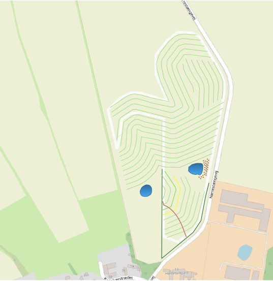
I've looked at a map of the area drawn by Anna Agger in QGIS on top of a drone photo. The planted rows of walnut and chestnut trees follow the topographic contours of the area. I've redrawn the map, the driveways, the paths, the planned water holes and brush fence by hand to get a better sense of it. I've looked at photos taken from the roadside last summer, expecting them to show more of the field than they did. I've made a few sketches of the young forest as seen from the roadside in bird's perspective.